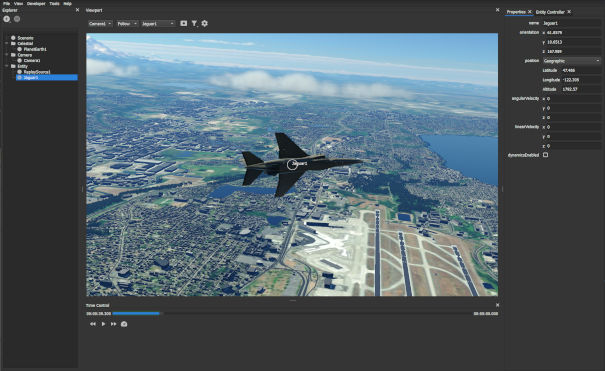
A C++/Python-based 3D geospatial application for simulating and visualizing dynamic objects in planetary environments.
- Create scenarios featuring dynamic 3D objects with modular components and properties.
- Interact with objects via 3D geospatial user interface.
- Render photoreal environments featuring terrain, ocean, buildings, roads, vegetation, and clouds.
- Import and visualize data from external sources including CSV files and CIGI host applications.
- Extend functionality with C++ and Python plugins.
Please refer to the Getting Started guide in the Skybolt documentation.
To submit a bug report, please raise an issue on the GitHub repository. For general discussion, please post on our GitHub discussions page. For business enquiries, please use our contact form.
This project is licensed under the Mozilla Public License Version 2.0 - see the License.txt file for details.


